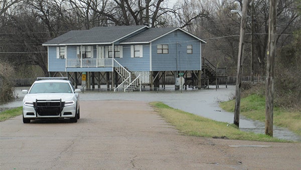
Above average flood risk projected for Vicksburg
Published 6:34 pm Saturday, February 24, 2018
An above average flood risk with minor to moderate flooding is forecast for the lower Mississippi Basin including Vicksburg, according to the year’s first flood potential report.
The National Weather Service’s late winter and early spring outlook for the basin was released Feb. 15, and the forecast is good through about mid-April, and indicated above average rainfall totals for the upper Mississippi and Ohio River basins.
The forecast is already being confirmed; based on heavy rainfall predictions in the upper basin, the National Weather Service has forecast the Mississippi River to crest at 47 feet March 12 in Vicksburg. The river was at 36.29 feet Saturday, and predicted to be at 40.9 feet by Wednesday. The flood stage here is 43 feet.
And predictions of an early rise in the river raise the question whether Warren County residents could see a repeat of the spring 2011 flood, when the Mississippi reached a record height of 57.1 feet, 14.1 feet above flood stage and nine-tenths of a foot above the Great Flood of 1927.
Weather Service officials and officials with the U.S. Army Corps of Engineers Vicksburg District said it is too early to tell if another 2011 flood may occur.
“It’s way too early; this is the first forecast. There’s a lot that can happen,” said Greg Raimondo, public affairs director for the Vicksburg District. “A lot will depend on how much rain we get in the upper basin.”
Under the present conditions, a 2011-type flood is unlikely, said Marty Pope, hydrologist with the National Weather Service Office in Jackson.
“Looking at everything now, based on all the rainfall we’ve gotten so far, even looking at the 16-day forecast — even if you went to the top end of that — as of now, we would not do that,” he said.
What made the 2011 flood unique, he said, was an early snowmelt.
“You had the snow melt early, and that hit the valley the same time all that heavy rain hit as well. That’s what helped push a lot of that water down here is they had so much from the snowmelt, too, on top of that.
“Luckily, right now, we’re not really playing with that as of now, but it doesn’t mean we won’t get there,” Pope added. “We’re early, this is an early year (forecast); the extended 90-day forecast still shows above normal rainfall over the Ohio Valley from March through May.”
The snowmelt, Pope said, is not a factor in this present flood forecast.
“It could come into play later. Most of the snow is up in the Northern parts like Wisconsin, Minnesota, to North and South Dakota and in the upper part of Missouri and Montana,” Pope said. “There’s a lot of stuff out there, but the stuff in Montana is going to be … you’re talking about weeks getting that down into the system. Right now, pretty much everything is staying pretty cold up through there.”
And while there is a good amount of snow in the extreme northern areas of the country, it is not contributing to the water heading into the Lower Mississippi Basin.
“Most everything now is based on rainfall, pretty much,” Pope said.
The seven-day forecast across the Upper Mississippi Basin, Pope said, indicates it will receive between 3 to 7 inches of rain across Arkansas and into portions of the Tennessee Valley as well as up into the Ohio Valley.
“So it’s going to be interesting. A front will move south and stall, and then move back north again, and then it’s going to move up to across Arkansas, Memphis (Tennessee) (and) possibly in portions of the Ohio Valley.”
But getting an accurate forecast, Pope said, will be difficult until the rain subsides and gives some of the rivers in the upper basin that flow into the Mississippi time to crest. Once the rains subside, he said, “you’ll be seeing greater confidence” in the forecasts.
While officials talk about the rainfall, another area closer to Vicksburg that’s under observation is the Steele Bayou Control Structure, which was built in 1969 to provide backwater flood protection from the Yazoo and Mississippi rivers.
Presently, Raimondo said, the structure’s gates are still open, adding the water behind the gates remains higher than the river level, “So as long as it’s higher on the landside than the riverside, the gates will stay open.”
He said engineers and hydrologists with the Vicksburg District are trying to determine how high the landside level will rise.
“If the river is higher than the landside, they’re going to close the gates to keep the river out.” Raimondo said. “Once the gates close, any water, any rain that falls in the backwater area, jut piles up, because it can’t get out.
“What we have right now, backwater is piling up right now, but the river’s coming up just a little bit slower than the water coming down Steele bayou. That’s why the gates are open. If the river speeds up — if the riverside starts going up faster and overtakes the landside — then we will have to close that gate off. Once we close the gate anything in there rises.
“We’re looking at river rising and we’re already expecting the water (inside the structure to go to probably 91 to 92 (feet),” Raimondo said. The level Saturday was 84.6, three-tenths of a foot higher than the riverside.
“The flood potential is above average risk, but at this point there’s the possibility of minor flooding,” he said. “That could change based on how much rain we get to the north. If the weather pattern changes and that pattern drops down, it’s to our advantage. But as long as we’re staying in this pattern right now, high than normal is the expected level of risk.”


