Farmers, rural areas feel the pain as backwater flood rises
Published 7:56 pm Tuesday, March 12, 2019

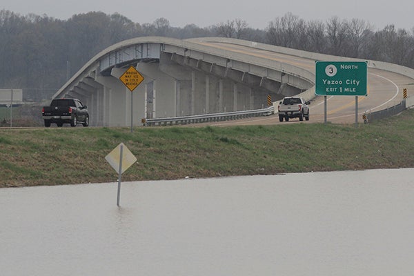
- Water from the Yazoo River creeps its way up towards U.S. 61 in Redwood. Federal, state and local emergency management officials will be conducting joint damage assessments in response to the severe storms and flooding impacting the state. (Courtland Wells/The Vicksburg Post)
ROLLING FORK (AP) — For decades, Peggy Sellars and her husband George have warily watched periodic floodwaters inundate the land around their home in the Mississippi Delta, but the dwelling always remained dry — until this year.
After weeks of fearful waiting, rising water finally got their house on Monday.
Two weeks ago, they had moved out of their residence east of Rolling Fork, correctly concluding the worst flooding since 1973 would overtop a small levee around their neighborhood. They returned twice a day to check things, worried about potential looters and the watery peril to their uninsured house.
Finally, a Monday afternoon boat ride showed the fate Peggy Sellars had feared.
“I’m devastated,” she said. “The water is in my house.”
The Sellars and the farmers who plant crops in the nearby Delta flatland are the latest victims of an unusual flood that involves flood-control structures.
Weeks of rainfall have fed high waters in the Mississippi River, which is lined with a levee that keeps those waters contained. Meanwhile, the Yazoo Backwater Levee also protects thousands of square miles from inundation that could back up the Yazoo River north of Vicksburg.
But the rain that swelled the Mississippi has also sent water rising between the backwater levee and the even taller levee along the Mississippi.
When water is low, the Big Sunflower River, the Little Sunflower River, Deer Creek and Steele Bayou exit the closed-in region through a floodgate along Steele Bayou, eventually reaching the Mississippi. But when the Mississippi is high, the gate is closed to protect against even worse flooding and water backs up across the flat land of the Mississippi Delta. And every time it rains upstream, more water heads south.
This year, the Steele Bayou floodgate has been closed since Feb. 15. Sharkey County Supervisor Bill Newsom said residents began noticing the water rising out of the wooded swamps about 10 days later. Now, engineers say the region is on track for the worst flood since 1973, before the levee was completed. The water’s steady, inch-by-inch rise is cutting off highways and isolating communities.
Without the backwater levee, the flood would actually be worse. But it’s bad enough. Peter Nimrod, chief engineer of the Mississippi Levee Board, says the flood will cover at least 500,000 acres, swamping fields 60 miles or more to the north.
Farmers will be hurt
In the sparsely populated area, most homes remain dry for now. Newsom estimates about 50 families have moved out across Sharkey County. A Red Cross shelter in nearby Mayersville has no occupants.
But the big economic blow will fall on farmers. By the time things dry out, it will be too late to plant corn. It may still be possible to plant cotton, but farmers might be limited to a late planting of soybeans. Albert Dornbusch, who farms 5,000 acres with his son, said they’ll probably limp by with the assistance of crop insurance payouts linked to their inability to plant, but he’s not sure.
“Tell me when it goes down,” Dornbusch said.
When the backwater levee was built, the plan was to pair it with giant pumps that would suck water out of the area, pushing it over the levee into a flooded Mississippi. But environmentalists fought the pumps for decades, saying they would dry out and destroy wetlands dotting the region. They also argued the pumps, estimated to cost $220 million, were too expensive and would mainly benefit farmers.
The U.S. Environmental Protection Agency vetoed the project in 2008. Advocates made a last-ditch attempt at getting Congress to mandate construction last year before U.S. Sen. Thad Cochran retired and left his powerful post as chairman of the Senate Appropriations Committee, but they failed.
Newsom remains an advocate of the pumps, saying agriculture is the region’s only industry. He said he doesn’t want to drain wetlands, just control high-water crests like the current one.
“We’re just wanting to have a flood level we can live in,” Newsom said.


