Vicksburg Police Department holds outreach session with Glenwood Circle residents, discusses bringing security cameras to the area
Published 2:25 pm Thursday, September 29, 2022

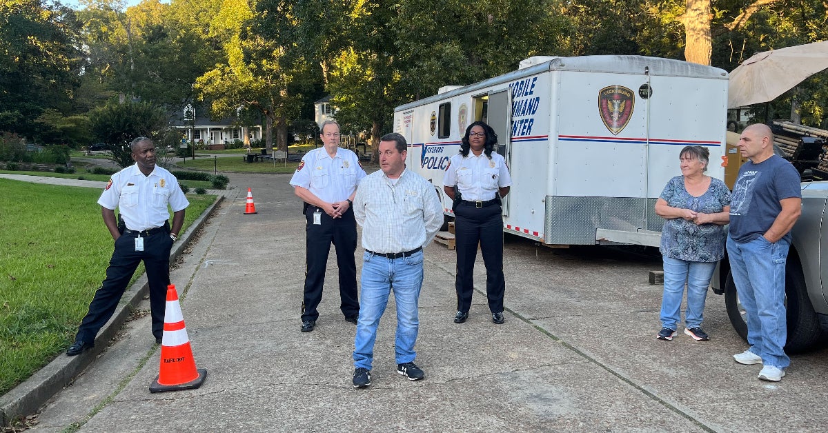
- Deputy Police Chief Charlie Hill, Deputy Police Chief Mike Bryant, Ward 2 Alderman Alex Monsour and Police Chief Penny Jones address Glenwood Circle residents by the park as part of an outreach program Wednesday evening. The group told residents about the city's new Project NOLA cameras and how they will help curb crime in the community. Catherine Hadaway/The Vicksburg Post
The Vicksburg Police Department visited the Glenwood Circle neighborhood Wednesday evening to talk to residents about a new high-tech video camera system that is being installed in the city of Vicksburg.
The cameras, operated by the non-profit group Project New Orleans, will be installed at locations across the city under a program called “Operation Safe Vicksburg.” VPD told Glenwood Circle residents that even though their neighborhood had not been selected as a site for the city-funded cameras, residents could come together to fund the cameras if they have a desire to increase security in the area.
“The camera would almost be like your police officer in your neighborhood,” VPD Police Chief Penny Jones said as she addressed residents about the camera system.
Jones said The Wildwood neighborhood association had purchased the Project NOLA camera system about a year ago and could be contacted if Glenwood Circle residents had additional questions.
VPD plans to hold future outreach sessions and said they would be in the Belle Meade neighborhood Thursday evening.
In July, the Vicksburg Board of Mayor and Aldermen approved a resolution to acquire and install the camera system. The city’s total cost of installation has not yet been determined, but a portion of $2.66 million of American Recovery Plan Act funds recently received by the city will cover the costs of the cameras.
According to Project NOLA, the average cost of each camera from the organization is $150. Average installation costs are $150, and the annual operating costs of the cameras are an average of $180 per year. Part of the cost is determined by the needs of the area.
The Project NOLA cameras are able to record video at 32 megapixels. The software used by the cameras contains many automated systems for facial recognition and license plate recording. Tags are then automatically applied to vehicles and individuals. So a law enforcement officer can, for instance, search the records for a man in shorts with a red shirt or a particular license plate, and then be presented with corresponding video footage as opposed to sifting through hours of video recordings.
The video and data collected are stored on servers at Project NOLA for two weeks, where it is readily available to law enforcement. VPD plans to create its own local monitoring station.
According to the resolution, three different types of cameras will be installed in the city:
• Cameras with gunshot detection ability will be installed at 26 locations.
• License plate reader cameras that can get numbers and letters from a license plate will be installed at Washington Street near Ameristar Casino, the North and South parking garages, Fisher Ferry Road at Sports Force Parks on the Mississippi, Clay and Hope Street, all Interstate 20 intersections and the intersection of South Street and Washington Street.
• PTZ cameras will be installed at 24 locations. According to manufacturer PTZ Optics, A PTZ camera is a pan, tilt, and zoom robotic video camera controlled by a remote operator to pan horizontally, tilt vertically and diagonally, and zoom in on a subject to enhance the image quality without digital pixelation.
Camera Locations Are:
PTZ Cameras with Shot Spotter Ability
- The intersection of Alcorn Drive and Mission 66
- The intersection of Alma Drive and Ethel Street
- The intersection of Clay Street and Baldwin Ferry Road
- The intersection of Clay Street and Mission 66
- The intersection of Clay Street and Cherry Street
- The intersection of Clay Street and Washington Street
- Estate Drive (Eastview Apartments)
- The intersection of Grove Street and First North Street
- The intersection of Grove Street and Levee Street
- The intersection of Halls Ferry Road and Lane Street
- The intersection of Harrison Street and Court Street
- The intersection of Lakehill Drive and Eastover Drive
- The intersection of Lakehill Drive and Carroll Place
- The intersection of Lane Street and Military Avenue
- The intersection of Locust Street and Jefferson Street
- The intersection of Martin Luther King, Jr. Blvd and Openwood Street
- The intersection of Martin Luther King, Jr. Blvd and Mission 66
- The intersection of Meadow Street and Letitia Street
- The intersection of National Street and Second Avenue
- The intersection of Polk Street and Second Avenue
- The intersection of Security Street and Mattingly Street
- City Park, at the intersection of Farmer Street and Randolph Street
- City Park, on Ken Karyl Drive
- The intersection of Bowmar Avenue and Drummond Street
- The intersection of First North Street and South Street
- Enchanted Hill Subdivision (Kings Row)
License Plate Reader Cameras
- Washington Street near Ameristar Casino
- North Parking Garage
- South Parking Garage
- Fisher Ferry Road (Sports Force Park)
- Clay Street and Hope Street
- All Interstate 20 interchanges
- The intersection of South Street and Washington Street
PTZ Cameras
- The intersection of Berryman Road and Maxwell Drive
- The intersection of Drummond Street and Speed Street
- The intersection of Drummond Street and Polk Street
- The intersection of Grove Street and Mission 66
- Hall Road
- The intersection of Martin Luther King, Jr. Blvd and Alcorn Drive
- The intersection of Washington Street and North Frontage Road (near Enterprise Rental)
- The intersection of Wisconsin Avenue and Bazinsky Road (near the car wash)
- City Park is located on Sherman Avenue
- Army Navy Drive (camera near the softball fields)
- 800 Block of Washington Street
- City Pavilion and City Pool
- Crawford Street and Gordon’s Alley (needs two cameras)
- 1100, 1200 and 1500 Blocks of Washington Street
- Vicksburg Auditorium (Main Street by Health Department)
- Porters Chapel Park (corner side of Wisconsin Avenue)
- Cherry Street and Grove Street
- Jackson Street Community Center (possible 360-degree camera at the corner of Jackson Street and Walnut Street)
- Depot Street and Washington Street
- Waterfront Park
- Shady Lane
- Starlight Drive
- The intersection of Veto Street and Washington Street
- The intersection of South Madison Street and Washington Street
Ben Martin and John Surratt contributed to this report.


